Deakin University is about to launch its major new seafloor mapping program from Warrnambool after a funding boost for the significant project.
Subscribe now for unlimited access.
or signup to continue reading
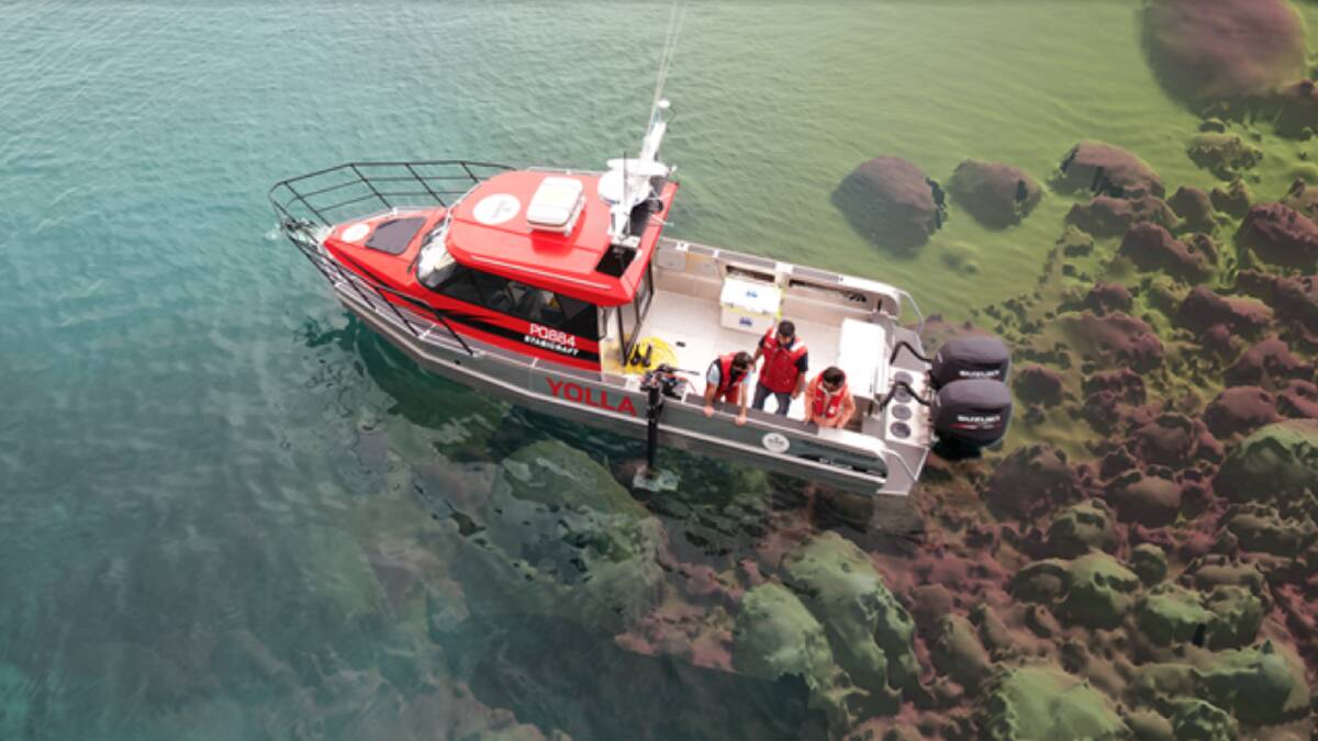
The research team's Warrnambool-based vessel Yolla will be used to do the work because of its advanced seabed mapping capabilities, and modifications made to the city's new boat ramp has meant the project can launch from its home port.
The boat was unable to launch following the upgrade late last year but within a week the issue had been rectified with the necessary modifications carried out after an onsite meeting between Better Boating Victoria and Warrnambool City Council.
Associate professor of marine science at Deakin's Warrnambool campus Dr Daniel Ierodiaconou said the council and Better Boating had done everything in their power to make it happen.
"We are very proud to have our Deakin Marine Mapping operations based out of Warrnambool and to be part of a community where we can work with our stakeholders and collaborators to be able to come up with solutions just like this in such a rapid period of time," Dr Ierodiaconou said.
"Yolla is one of the most sustainable and economical seabed mapping vessels in Australia. Being able to transport to boat ramps for deployments is critical to the success of the program and limiting transit times."
Dr Ierodiaconou said the mapping program would build on more than a decade of work surveying the seabed using multi-beamed sonar mapping technology. "The significance of this work is immense," Dr Ierodiaconou said.
"For some areas, this is the first information that has been obtained since Matthews Flinders took depth readings from his boat, the Investigator, in 1803."
Deakin's marine mapping group received new funding to map the seafloor under the waves between Portland and Warrnambool from the Department of Energy, Environment and Climate Action and industry partner Garmin.
"For the first time we will be able to provide accurate and comprehensive picture of life and the diversity of marine habitats along the coast, including hotspots for marine plants and animal communities," Dr Ierodiaconou.
The data would also look at the off-shore sediment supply needed for our beaches.
"We are trying to link what is happening on the beaches in a changing climatology, to understand wave climate and how that is changing the coastline. Understanding the sediment offshore is critical," Dr Ierodiaconou said.
The Warrnambool harbour has been a test location in the past where marine science students have undertaken repeat surveys to document sediment movement in the harbour
Previous mapping discoveries include unknown "gardens" of magnificently coloured sponges, seaweed forests and seagrass meadows, shipwrecks and submerged river systems and lagoons that would have supported Aboriginal communities at lower sea levels.
"The works will improve conservation planning, fisheries management, and infrastructure planning to limit impacts on the environment," Dr Ierodiaconou said.
"More than ever before we will be better informed about ways to conserve these areas and the life they contain for future generations to enjoy."
Dr Ierodiaconou will be giving a presentation to the Warrnambool Offshore & Light Game Fishing Club on Thursday, January 19 at 7pm.
IN OTHER NEWS
- Bookmark https://www.standard.net.au/
- Make sure you are signed up for our breaking and regular headlines and newsletters
- Follow us on Facebook, Twitter, Instagram and LinkedIn
- Tap here to open our Google News page
- Join our Courts and Crime Facebook group and our dedicated Sport Facebook group
- Subscribe
Have you signed up to The Standard's daily newsletter and breaking news emails? You can register below and make sure you are up to date with everything that's happening in the south-west.


